Participatory Land Cover Monitoring of Cambodian Landscapes
Background
According to several global forest loss assessments, Cambodia has one of the fastest rates of deforestation worldwide. This has short-term impacts on communities and threatened species, and medium term impacts on weather patterns and potential for agriculture. In a country where land-use is changing rapidly, tools that can quantify ‘activity data’ on land-use change are essential. As Cambodia advances down a path of green-growth, there is a need to develop government-owned tools, procedures and systems that can monitor a wide range of such ‘activity data’. Many remote sensing efforts in Cambodia have had modest success in monitoring closed evergreen and semi-evergreen forest but struggled to reliably identify change for dry deciduous forests and grasslands. This results in extensive manual editing and very long production times. Technical capacity within developing countries is commonly cited as a barrier to developing GHG monitoring systems.
Overall Objective
Develop remote sensing monitoring methods, tools and procedures to support landscape management in Cambodia.
Expected Results
- MOE aware of monitoring needs for land-cover and how they can be fulfilled.
- Remote sensing land cover classification procedures made accessible to MOE staff.
- Inputs and procedures necessary for developing the tool are established.
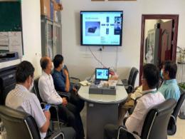
- MOE staff have the capacity for interpreting remote sensing imagery and are operating the demonstration land-cover classification toolset.
Location
Cambodian Protected Areas to be selected based on a needs assessment conducted as a project activity
Approach
Satellite data using Synthetic Aperture Radar (SAR) is now available from the Japan Aerospace Exploration Agency (JAXA) and the European Space Agency (ESA). SAR is not reliant on photosynthetic vegetation and instead identifies structural components of vegetation such as tree branches or grass blades which provides an alternative method for identifying land cover. Used in conjunction with multispectral imagery, the additional dimension of structural information from SAR imagery can be used to differentiate between leaf-off deciduous forest from non-forest and natural grassland from agriculture. Developments in temporal analyses allow for mapping seasonal effects to further assist in identifying land covers with complex phenology or other pronounced seasonal effects.
In addition to new satellite sensors and mapping techniques, remote sensing technology is advancing rapidly with new software, much of which is Free Open Source Software (FOSS), and vastly enhanced computing platforms. Likewise, options for developing Internet-based applications for data collection, processing, and storage have also expanded In partnership with SERVIR-Mekong, the project will leverage these advances through Google Earth Engine and a wide network of international remote sensing experts and software developers. It will work with the GIS department of MOE to develop user-friendly procedures and train staff to use these new tools.
Achievements to date
- A comprehensive review of RGC land cover monitoring activities in Cambodia
- An assessment of MOE monitoring needs conducted. Assignment of needs to be addressed under Project. Plan to address other needs outside of the Project developed. Demonstration sites selected.
- Existing data layers for demonstration sites collected
- Aerial interpretation and testing data collected and stored within a database
- Land cover maps using cloud-based tool created
- Procedures combining local and cloud-based processes developed and documented
- Training and procedure documents developed
- Trainings held (at MOE)
- Tool results verified in the field (ground truth)

